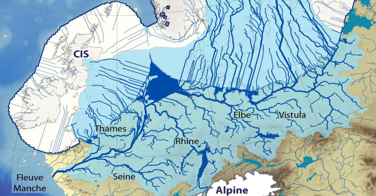
Covering most of northern Europe some 23,000 years ago, the Eurasian ice sheet was such an enormous conveyor of ice that one could have skied 4,500 km continuously across it – from Britain’s far southwestern isles to Franz Josef Land in the Siberian Arctic. Some speculate that at some points during the European deglaciation this river system had a discharge twice that of the Amazon today. As you can see below, its existence had a massive and extremely hostile impact on Europe at the time.

The ice sheet alone lowered global sea-level by over 20 meters. So it’s by no means surprising that it caused severe flooding across the continent as it melted and collapsed, which, in turn, led to dramatic sea-level rise, and diverted mega-rivers that raged on the continent. A new model investigating the retreat of this ice sheet and its many impacts has recently been published in Quaternary Science Reviews.
The study concludes that the sea level rise and the colossal amounts of meltwater discharged from the collapsing ice sheet meant that areas that previously were land eventually became seabed.
“Britain and Ireland, which had been joined to Europe throughout the last ice age, finally separated with the flooding of the English Channel around 10,000 years ago. It was the original Brexit, so to speak” says Alun Hubbard, one of the researchers behind the study.
Here’s an animation of how it all happened:

via Archeology News Network